

NORTHERN LAVREOTIKI
KILOMETERS
DURATION
ELEVATION
PROPOSED SEASON
DIFFICULTY
PHYSICAL CONDITION
TECHNICAL DIFFICULTY
STARTING POINT
Author:
G. Koutrotsios
Photos:
G. Koutrotsios - A. Leontaritis
Between abandoned mines, forgotten tunnels and ancient passages, northern Lavreotiki reveals a unique network of trails. A route where thousands of years of history meet mountain biking, across a raw and authentic landscape with sweeping views of the Aegean Sea.
INTRODUCTION
Lavrio, or Lavreotiki, was the name given in antiquity to the hilly peninsula at the southeastern tip of Attica. The name Lavreotiki derives from the word “lavra” or “lavri”, meaning a narrow passage or tunnel – a defining characteristic of the area, which is scattered with ancient and more recent mining galleries.
Mining activity in the area began approximately 5,000 years ago, while the systematic exploitation of mineral resources started with the birth of the Athenian Democracy in 508 BC and continued uninterrupted throughout the Classical period. The importance of Lavrio was crucial to the Athenian economy: revenues from the sale of silver and lead financed the great public works of Pericles’ Golden Age, while the silver of Lavrio was used to mint the first Athenian coins, the famous “owls”, which dominated commercial transactions throughout the Mediterranean until the Roman era.
Three years before the naval Battle of Salamis (480 BC), new ore deposits were discovered and production increased significantly, generating enormous income for the Athenian state. At that time, following the proposal of Themistocles, the Athenians built 200 new triremes (fast warships powered by three rows of oars), which were added to the fleet and proved decisive in the victory against the Persians in the narrow straits of Salamis.
Silver production, however, required immense human sacrifice and did not always proceed smoothly. The appalling living and working conditions of the 15,000–20,000 enslaved workers led to repeated uprisings. In 413 BC, during the Peloponnesian War (a long and devastating conflict between Athens and Sparta for dominance in the Greek world), following the Spartan victory and the occupation of parts of Attica, the slaves defected to the enemy. This resulted in a suspension of mining operations for several years and triggered what is considered the first historically recorded economic crisis of Athens.
After the Classical period, all serious mining and metallurgical activity ceased, followed by many centuries of silence. The second flourishing of Lavrio came in 1865, when new facilities were established by the Italian mining engineer J. B. Serpieri and production resumed. The exploitation of the deposits was intensive, and the small settlement quickly grew into a town of 10,000 inhabitants by the early 20th century. The end of Lavrio’s mining history was effectively written during World War I and with the liquidation of the facilities, leaving indelible marks across the entire landscape.
Recognition of the area’s significant cultural and geological heritage came in 2024, when Lavreotiki was designated a UNESCO Global Geopark.
Time has faded the glory of those days, but countless trails have been left exposed. Routes once used for transporting ore now form a vast dirt labyrinth, ideal for mountain biking, which is steadily attracting more and more riders from the nearby capital.

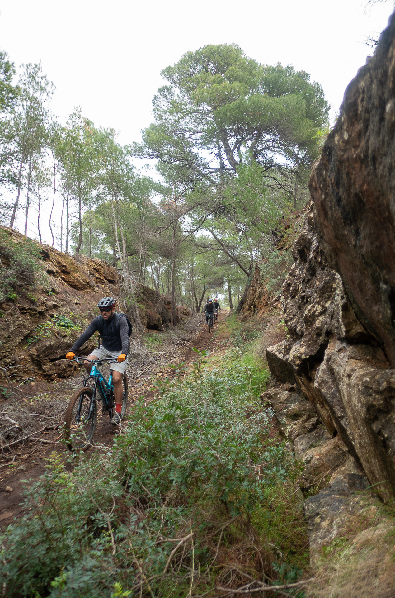
ROUTE DESCRIPTION
Η προτεινόμενη διαδρομή αναπτύσσεται στο βόρειο τμήμα της Λαυρεωτικής γης, στη λοφώδη περιοχή μεταξύ Αγίου Κωνσταντίνου και Κερατέας. Περνά από σημαντικά μνημεία που σχετίζονται με την εξόρυξη μεταλλευμάτων, διασχίζει εύκολα αλλά και τεχνικά μονοπάτια μεγάλου μήκους, πευκοδάση και μια «αέρινη» κορυφογραμμή με εντυπωσιακή θέα στο Αιγαίο και τη γύρω περιοχή.
Οι εναλλαγές στις κλίσεις και στο τερέν είναι συνεχείς και απαιτούν καλή φυσική κατάσταση, καθώς και καλό χειρισμό του ποδηλάτου, ιδιαίτερα στα κατηφορικά τμήματα της διαδρομής. Ιδανικότερη εποχή για να την απολαύσει κανείς είναι ο χειμώνας, όταν οι θερμοκρασίες είναι ήπιες και η ορατότητα στην κορυφογραμμή εντυπωσιακή.


30,9 km.
ROAD
DIRTROAD
BAD DIRTROAD
PATH
30,9 km.
ROAD
DIRTROAD
BAD DIRTROAD
PATH
ROAD
BAD DIRTROAD
DIRTROAD
PATH
GALLERY


ROAD BOOK
| Distance between points | Total distance | Description | |
|---|---|---|---|
| 0 | 0 |  |
Start at the junction of Old Athens–Lavrio Road and Koimiseos Theotokou Street in Markati Lavriou. Ride north along Koimiseos Theotokou Street. |
| 0.7 | 0.7 |  |
At the end of the road, continue straight onto the dirt road towards the metal bridge. Ride on the trail to the right of the bridge. |
| 0.1 | 0.8 |  |
On the dirt road, turn left. |
| 0.3 | 1.1 |  |
On the paved road, turn right. |
| 0.1 | 1.2 | |
At the first junction, go straight. |
| 0.8 | 2.0 |  |
At the first dirt road, turn diagonally left and slightly backwards. |
| 0.2 | 2.2 | |
On the paved road, turn left (uphill). |
| -0.8 | 2.4 |  |
At the first fork, turn right onto a dirt road. |
| 0.3 | 2.7 | |
At the end of the dirt road, turn left (uphill) onto Ioanninon Street. |
| 0.1 | 2.8 | |
After 50 m, turn right onto Agiou Pavlou Street. |
| 3.1 | 5.9 |  |
Directly beneath the high-voltage power lines, turn left (uphill) at the fork. |
| 0.4 | 6.3 | |
At the end of the road, turn left (uphill). |
| 2.1 | 8.4 |  |
At the top of the climb, turn right (uphill) towards the power lines. |
| 0.8 | 9.2 |  |
At the three-way junction, follow the middle track (slightly to the right). |
| 0.8 | 10.0 | |
After the first descent, turn right at the fork onto a rough dirt road. |
| 2.0 | 12 | |
At the end of the descent, turn left onto the singletrack running parallel to the fence. |
| 0.2 | 12.2 |  |
At the end of the fence, continue straight, crossing the stream perpendicularly. |
| 0.2 | 12.4 | |
At the end of the trail, turn left onto a dirt road. |
| 1.2 | 13.6 | |
At the end of the road, turn left onto a better-quality dirt road. |
| 0.5 | 14.1 | |
At the abandoned concrete building, turn right at the fork |
| 0.8 | 14.9 | |
At the next fork, turn left (just before the small chapel). |
| 0.5 | 15.4 |  |
At the end of the steep descent, turn right (same road used earlier). |
| 0.8 | 16.2 | |
At the end of the descent, turn left. |
| 0.7 | 16.9 |  |
Ignore two side roads (right and left) after the abandoned house. |
| 0.2 | 17.1 | |
At the end of the road, turn right (slightly downhill) at the fork. |
| 1.1 | 18.2 | |
At the end of the road, go straight across the junction onto the paved road. |
| 0.4 | 18.6 | |
At the house, turn left (uphill) onto the concrete road. |
| 0.5 | 19.1 | |
At the first concrete road, turn right (uphill). |
| 0.5 | 19.6 |  |
At the first road encountered, turn diagonally right and slightly backwards. |
| 0.7 | 20.3 | |
At the end of the dirt road, turn right (uphill) onto a concrete road. |
| 0.1 | 20.4 | |
Shortly after, turn left. |
| 0.3 | 20.7 | |
At the start of the descent, turn left at the fork. |
| 0.5 | 21.2 | |
At the next fork, turn right |
| 0.8 | 22.0 | |
At the next fork, turn left onto a steep climb |
| 0.9 | 22.9 | |
After the metal water tank, turn left at the fork |
| 0.6 | 23.5 | |
At the entrance of Agios Konstantinos village, continue straight onto Frearion Street. |
| 0.2 | 23.7 |  |
At the second road, turn left onto Dimokratias Street. |
| 0.05 | 23.8 | |
After 50 m, turn right at the fork |
| 0.5 | 24.3 |  |
At the basketball court, turn left. |
| 0.2 | 24.5 | |
At the first fork, turn right onto Markati Street and immediately diagonally right onto a dirt road. |
| 1.8 | 26.3 |  |
Just before the end of the road, turn diagonally left onto a steep climb. |
| 0.3 | 26.6 | |
After the large parking area, turn right downhill onto the concrete road. |
| 0.1 | 26.7 | |
Shortly after, turn diagonally left onto a trail passing beneath a stone structure. |
| 1.4 | 28.1 | |
At the trail junction, turn left. |
| 0.4 | 28.5 | |
At the end of the trail, turn left onto a dirt road. |
| 11.4 | 29.9 | |
At the three-way junction, turn right towards Markati |
| 0.1 | 30.0 | |
At the junction, continue straight onto the paved road and return to the starting point. |