

RAMNOUNDA
KILOMETERS
DURATION
ELEVATION
PROPOSED SEASON
DIFFICULTY
PHYSICAL CONDITION
TECHNICAL DIFFICULTY
STARTING POINT
Author:
G. Koutrotsios
Photos:
V. Karalaios - G. Koutrotsios
Under the gaze of Thetis and Nemesis
When a route combines a visit to one of the last remaining stone bridges of Attica, the unique archaeological site of Rhamnous, quiet beaches perfect for a refreshing swim, ancient roads once used by our ancestors over 2,000 years ago, and ends at a seaside taverna with excellent food — words can hardly do it justice.
INTRODUCTION
To complete the route, one only needs to pedal for about 3–4 hours.
But to reach the true starting point of Rhamnous’ story, one must travel several centuries back in time.
The ancient deme of Rhamnous dates from the 5th century BC and belonged administratively to Athens. Built in a strategic location, it oversaw all movement along the Euboean Gulf and was known for its fortress, small port, and most importantly, its sanctuary. The inhabitants’ houses were close to the sea, and nearby stood the Sanctuary of Nemesis — the most relentless of all deities toward those who lived impiously. This was the most important sanctuary in Greece dedicated to Nemesis. Alongside her was worshipped Themis; both were personifications of abstract concepts — Nemesis representing just retribution, from which no one could escape, and Themis symbolizing law, order, and justice.
Today, in addition to the sanctuary, one can see part of the fortress “Ovriokastro,” the ancient settlement, the theater, and several funerary structures.
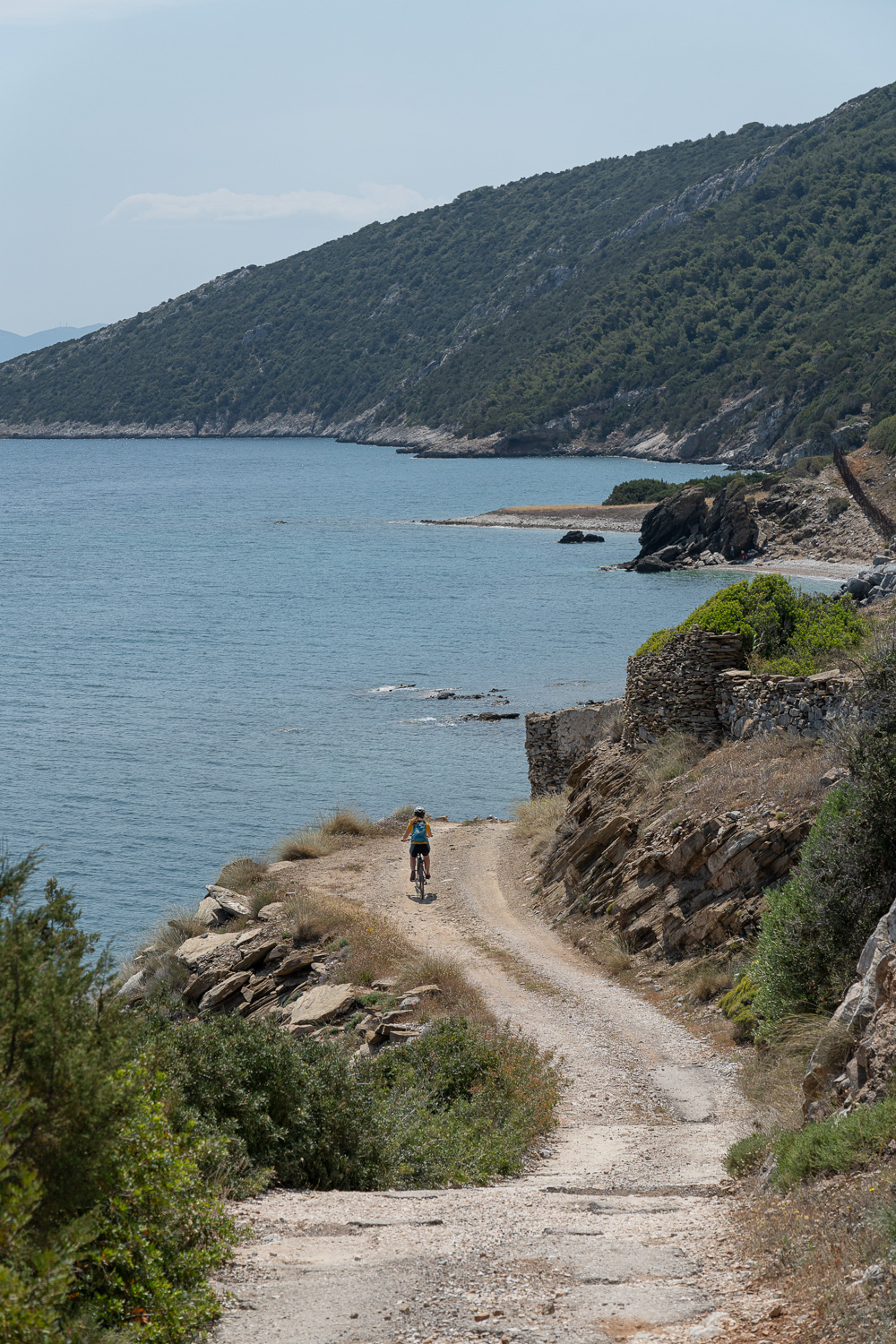
Beyond the archaeological site, there are also remains of the iron ore loading facilities just before Limnionas beach. During the summer months, there are several swimming options along the route — we recommend the two coves directly below the ancient settlement. Quiet and with crystal-clear waters, they are ideal for swimming and relaxation.
Finally, don’t rush to head back; the area has several excellent tavernas where you can “restore” your lost energy!


ROUTE DESCRIPTION
The route begins at the entrance of the archaeological site of Rhamnous.
An old dirt road first crosses a small plain before turning into a paved uphill section that leads to the outskirts of Grammatikó. Here begins the most beautiful part of the ride.
It first passes next to the impressive stone bridge once used by the railway line connecting Grammatikó with Sesi, which transported iron ore. The route then climbs steeply (10–15%) until it meets the asphalt road. From there, a 7–8 km downhill dirt road with stunning views of the Euboean Gulf leads to Sesi beach — the only spot along the route where you can find water and food (but perhaps save your appetite for the Rhamnous taverna).
In the final kilometers, a coastal dirt road — parts of which date back more than 2,000 years, as it once connected Rhamnous with the Amphiareion sanctuary — takes you back to the starting point.


27.7 km.
ROAD
DIRTROAD
BAD DIRTROAD
PATH
27.7 km.
ROAD
DIRTROAD
BAD DIRTROAD
PATH
ROAD
BAD DIRTROAD
DIRTROAD
PATH
GALLERY


- POINTS OF INTEREST
Here visitors can admire the ancient sanctuary dedicated to Nemesis, the theater, several funerary monuments, and the remains of the ancient settlement. Around the site, parts of the fortress “Ovriokastro” are still visible.
To transport iron ore from the Grammatikó mines (1890–1910), a local railway network was built that reached the beach of Limnionas. From that network, a beautifully preserved stone arch bridge remains, constructed in 1892 by Haton — the same engineer who built the Kalavryta cog railway in Peloponesse.
ROAD BOOK
| Distance between points | Total distance | Description | |
|---|---|---|---|
| 0 | 0 |  |
Starting point: Entrance to the archaeological site of Rhamnous. Begin on the rough dirt road opposite the gate |
| 0.9 | 0.9 |  |
At the only fork in the fields, go straight (left) |
| 0.5 | 1.4 |  |
|
| 0.7 | 2.1 |  |
At the perpendicular dirt road, turn right |
| 0.3 | 2.4 |  |
At the paved road, turn left (toward Athens) |
| 0.3 | 2.7 |  |
At the main paved road, go straight (right, again toward Athens) |
| 0.3 | 3 | |
At the first paved road, turn right toward Grammatikó |
| 3.4 | 6.4 | |
On the main road to Mikró Sesi, turn left, slightly uphill |
| 1.2 | 7.6 |  |
|
| 1.1 | 8.7 |  |
As the downhill begins, turn right onto a dirt road (just opposite the marble monument of Prophet Elias) |
| 0.2 | 8.9 |  |
After the small church of Prophet Elias, turn left onto a narrow dirt road to visit the stone bridge; return the same way |
| 1.2 | 10.1 |  |
|
| 0.7 | 10.8 |  |
|
| 0.6 | 11.4 | |
At the paved road, turn right |
| 0.1 | 11.5 |  |
After a while, at the white roadside shrine, turn left onto a dirt road |
| 0.9 | 12.4 |  |
Ignore three right-hand roads; at the fourth, turn diagonally right toward the sea |
| 3.6 | 16.0 | |
|
| 1.1 | 17.1 | |
|
| 0.3 | 17.4 | |
At the end of the dirt road, turn right on the paved road toward Sesi |
| 1.7 | 19.1 | |
Pass the beach and after the first uphill, turn left onto the first dirt road |
| 0.1 | 19.2 |  |
Ignore the concrete road left to Kato Sesi, continue straight uphill |
| 1.1 | 20.3 | |
Turn left onto the dirt road toward Limnionas |
| 0.4 | 20.7 | |
At the first fork, turn right |
| 2.9 | 23.6 | |
At the end of the coastal dirt road, turn right |
| 2.1 | 25.7 | |
At the paved road, turn left toward Rhamnous |
| 0.3 | 26.0 | |
At the first dirt road, turn left downhill |
| 0.6 | 26.6 | |
At the first fork, turn left, slightly downhill |
| 0.4 | 27.0 | |
At the second fork, again turn left |
| 0.3 | 27.3 | |
At the end of the road, turn right onto a perpendicular dirt road leading back to the starting point |