

DIONYSOVOUNI
KILOMETERS
DURATION
ELEVATION
PROPOSED SEASON
DIFFICULTY
PHYSICAL CONDITION
TECHNICAL DIFFICULTY
STARTING POINT
Author:
G. Koutrotsios
Photos:
V. Karalaios
From Dionysos to Rapentosa
A route along quiet dirt roads and rideable trails, crossing the “Kibetoúi” stream, visiting the small wetland and the Rapentosa waterfall—the tallest waterfall in Attica—all just a breath away from the northern suburbs of Athens.
INTRODUCTION
The route unfolds along the northern foothills of Mount Penteli, specifically on the small and little-known Dionysovouni, whose highest peak reaches 651m. The mountain’s gentle slopes were once covered in dense pine forest, which shared the fate of many woodlands lying too close to the city of Athens. Three major fires between 1996 and 2009 devastated the area, leaving behind only pockets of vegetation that now struggle to multiply and restore the landscape’s former glory. The scenery, however, changes dramatically at the eastern end of the route, where around the Rapentosa dam and waterfall, lush vegetation thrives. Water flows year-round, creating a small wetland—a haven for a variety of birds, reptiles, and amphibians—while the waterfall itself remains one of Attica’s hidden gems (though for how long, no one knows).


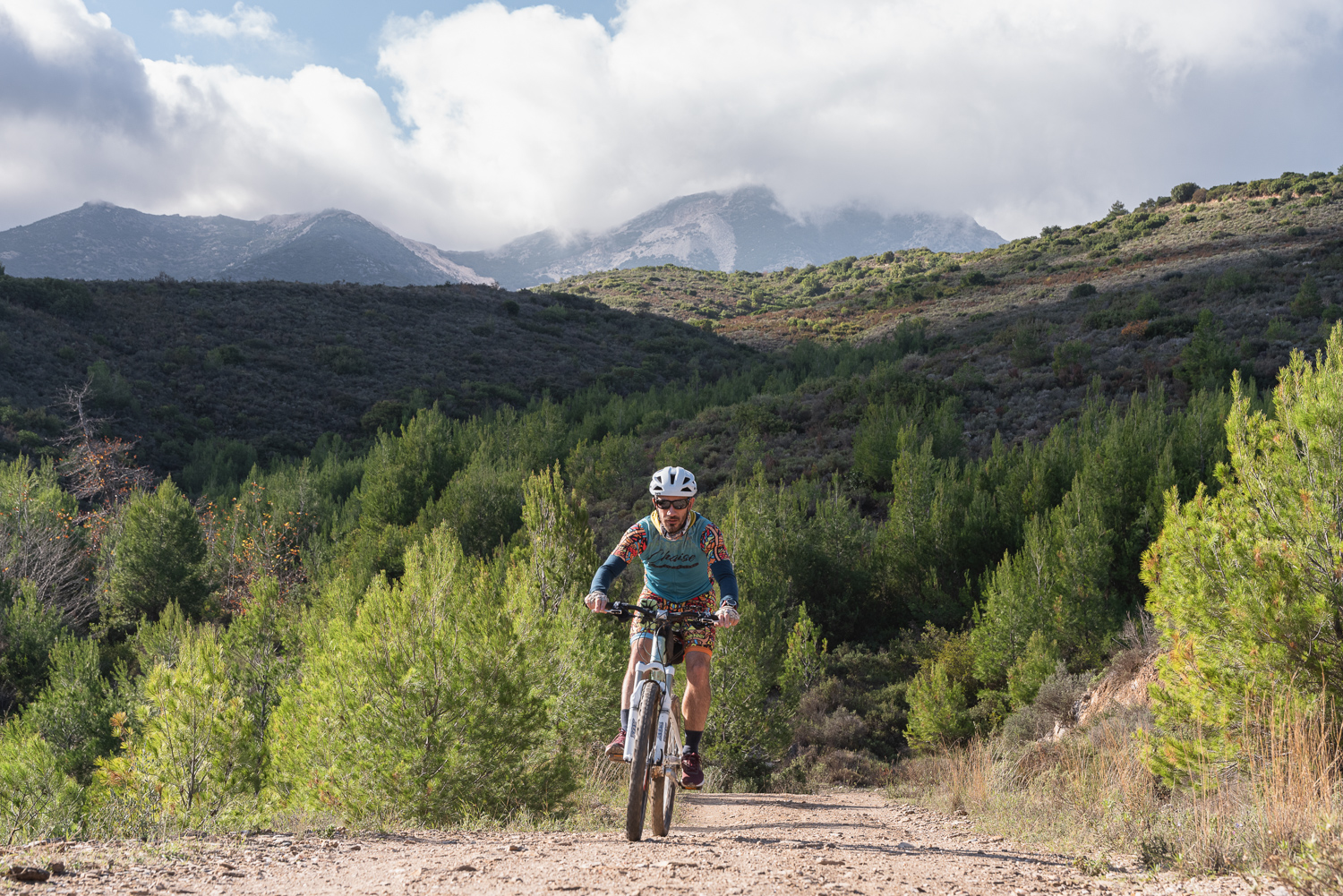
ROUTE DESCRIPTION
The starting point lies at the northeastern edge of Dionysos. The route first crosses Dionysovouni, descending via smooth dirt roads to the Rapentosa wetland. Here begins the most adventurous and captivating section: a well-marked downhill trail leads to the dam, and from there, following the riverbed for about 1 km—sometimes riding, sometimes pushing the bike—we reach the Rapentosa waterfall. The journey concludes with a gentle 9 km climb on compact dirt and paved roads, leading back to the starting point.


23.8 km.
ROAD
DIRTROAD
BAD DIRTROAD
PATH
23.8 km.
ROAD
DIRTROAD
BAD DIRTROAD
PATH
ROAD
BAD DIRTROAD
DIRTROAD
PATH
GALLERY

- POINTS OF INTEREST
The tallest waterfall in Attica, standing at 15m. It’s an ideal spot for a break, rest, or even a refreshing shower during the summer months. To reach it, follow the stream upstream from the point where the dirt road meets the ravine.
Until 2004, the Rapentosa area was a small valley north of mount Penteli. That year, a dam was built by the Athens Water Supply and Sewerage Company (EYDAP) to control the floods that plagued Marathon’s wider region. The construction created a reservoir holding 1,265,000 cubic meters of water. Today, it is one of Attica’s few wetlands, playing a crucial role in preserving the area’s rich birdlife.
ROAD BOOK
| Distance between points | Total distance | Description | |
|---|---|---|---|
| 0 | 0 |  |
Starting point: 40 Arkadias Street, Dionysos. Continue uphill along the same road. |
| 0.4 | 0.4 |  |
At the beginning of the dirt road, keep left at the fork. |
| 3.1 | 3.5 |  |
At the cemetery entrance, turn right downhill. |
| 0.1 | 3.6 |  |
Just past the cemetery, turn left (continuing on the same road). |
| 0.8 | 4.4 |  |
At the junction, turn right downhill. |
| 1.2 | 5.6 |  |
On the paved road, turn right. |
| 0.3 | 5.9 | |
Turn right onto the first paved road toward “Makrypoúri.” |
| 2.5 | 8.4 |  |
At the road’s end, turn left downhill onto a wide dirt road. |
| 3.2 | 11.6 |  |
At the junction with a fire-fighting water tank, go straight. |
| 0.5 | 12.1 | |
Turn right at the first road. |
| 1 | 13.1 | |
Just past the plastic tank, turn left onto a rough dirt road. |
| 0.8 | 13.9 |  |
At the end of the downhill path, turn right. Follow the riverbed toward the dam. |
| 0.2 | 14.1 | |
Push the bike briefly uphill onto a dirt road and turn left |
| 0.2 | 14.3 |  |
Immediately after the stream, turn left, continuing along the riverbed (bike carrying required in some sections). |
| 0.9 | 15.2 | |
At the end of the trail, turn right onto a dirt road. |
| 0.1 | 15.3 |  |
Where the stream crosses the road, take the 200m trail to the Rapentosa waterfall. |
| 1.1 | 16.2 | |
At the end of the climb, at the junction with a fire tank, turn left. |
| 2.9 | 19.2 | |
At the road’s end, turn left onto a wide dirt road |
| 0.7 | 19.9 | |
At the end of Skarpas Street, turn left onto a wide dirt road. |
| 1.1 | 21 |  |
At the junction for Athens (right), continue straight. |
| 0.9 | 21.9 | |
Turn left onto Evrytanias Street (next to the cement wall). |
| 0.1 | 22 | |
Take the first left onto Galinis Street. |
| 0.2 | 22.2 |  |
After the monastery, turn left at the Church of St. Athanasios. |
| 0.9 | 31.1 | |
Turn right onto the first dirt road encountered while climbing. |
| 0.6 | 31.7 | |
At the dirt road’s end, turn left onto a cement road, returning to the starting point. |